ASPHALT
hard
Stage 2
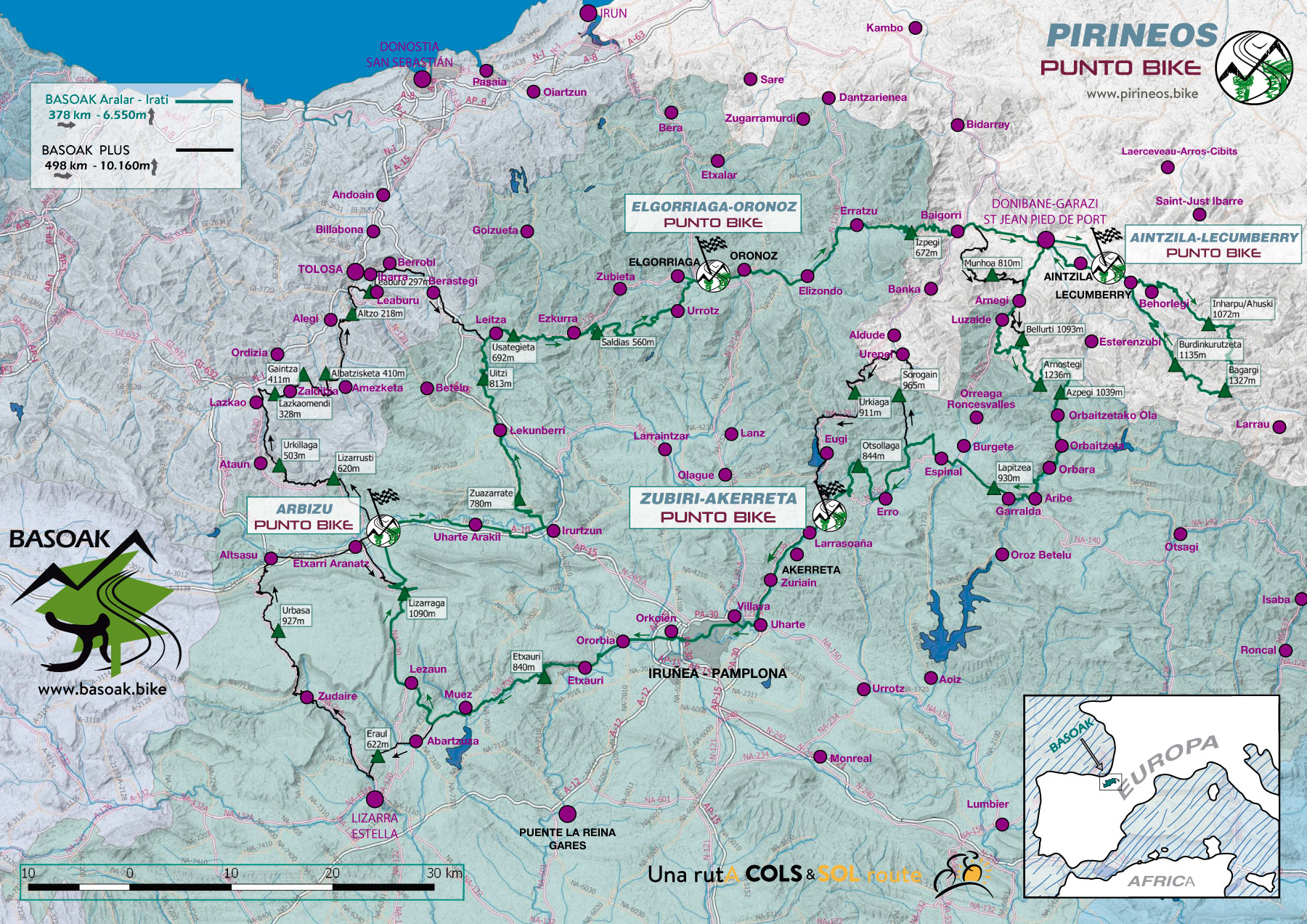
ELGORRIAGA/ORONOZ - IRATI
Distance: 110 km Unevenness: 2.310 m
Queen stage. Perfect for bicycle touring across the massif of Arbailles and the forest of Irati.
Territory chosen to stage Queen of Tour of Spain 2016.
This second day is as we say the "Queen stage" of BASOAK. It is therefore also the most demanding. Climbing Inharpu, the COL chosen by the Tour of Spain 2016 to begin its stage Queen. In just 10 kms, this port acquires 254 points of difficulty APM coefficient, only one less than the 255 reaching the legendary Aubisque, the COL that completes that stage, Add to this that in this case 17 kms are needed to get those points.
You'll be pleased to know that from Bagargi on (km 83), except for a small climb to Burdinkurutzeta, everything else is a pleasant descent.
Depending on the availability of the accommodation, we will end up in Aincille or Lekumberry.
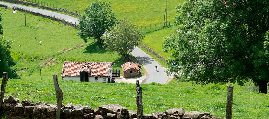
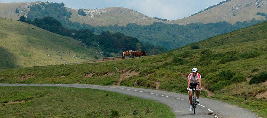
First effort of the day on the gentle slopes of Izpegi Port.
Spectacular landscapes descending the Port of Izpegi towards Baigorri.
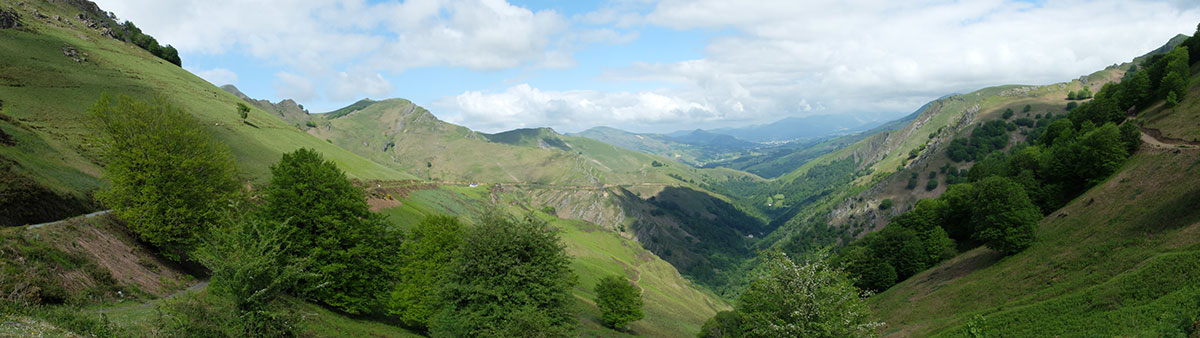
Views from the Izpegi COL towards the Pyrenees.
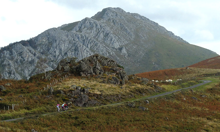
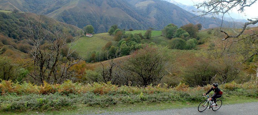
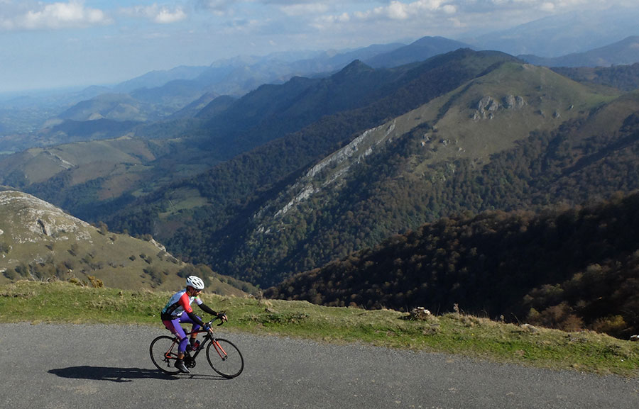
Ascending Ausky by Bastida, the ascend by which it was promoted in La Vuelta a España 2016. If it is hot we recommend the option of ascent by Behorlegi that is for which "officially" ascends BASOAK.
In the upper area of the same port as the previous photo.
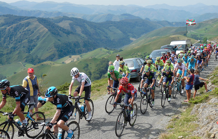
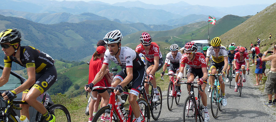
The "Duel" of the Vuelta a España 2016 on the last ramps of Inharpu.
Territory 5 stars in the massif of the Arbailles. Inharpu/Ahusky.
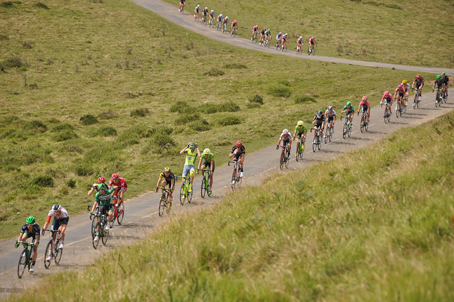
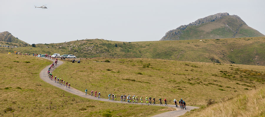
The peloton of the Vuelta a España 2016 in the same place as the previous photo.
The Sky and 3 "maillots" visiting BASOAK, white Froome, green Valverde and red Quintana.
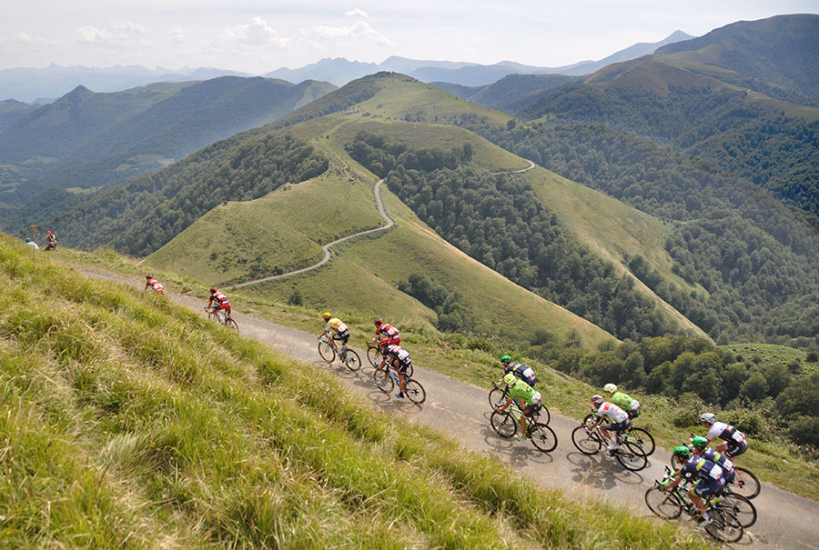
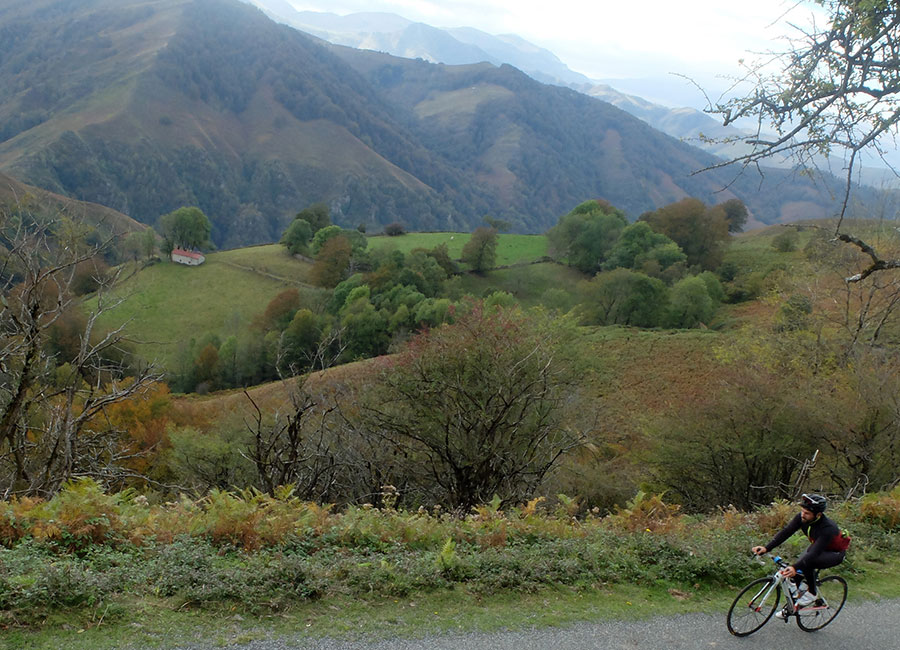
Ridge between Ahusky and Bagargi. On clean days the view extends on the right to the Gulf of Bizkaia and on the left towards the high peaks of the Pyrenees. Without any doubt, one of the best sections of cycling in the whole Pyrenees. The peloton of La Vuelta España 2016 is marching towards the Central Pyrenees. We will continue along the Cordillera road to look for Bagargi and Casas de Irati.
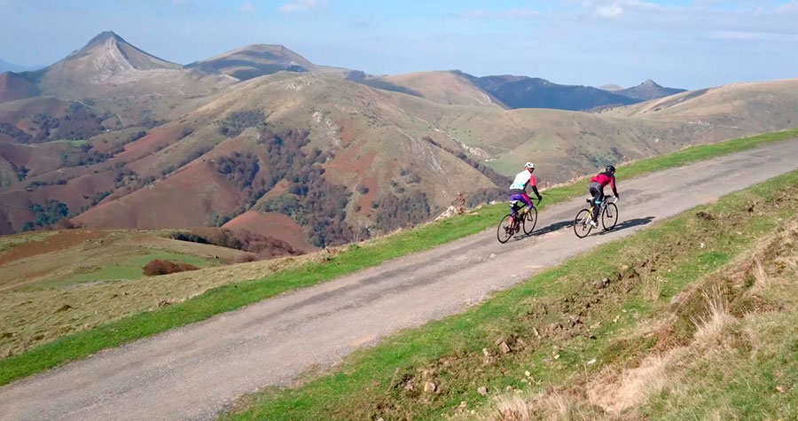
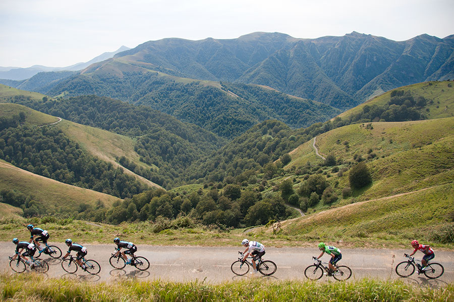
"Negotiating" the crest towards Bagargi, the Arbailles massif is left behind.
We continue looking for Bagargi.
Participants of the Irati Extrem 2013 in Irati-Cize. At this point begins our last climb of the day to the small Port (by this side) of Burdinkurutzeta.
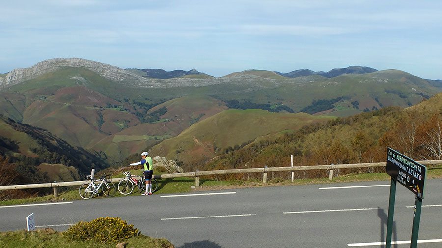
COL de Burdinkurutzeta. In the background the massif of the Arbailles through which we have spent throughout the day. There is only one perfect descent to Lecumberry left.
in preparation
Izpegi in altimetrias.net
Ahuski / Inharpu by Behorlegi in altimetrias.net
Ahuski / Inharpu by Bastida (Tour of Spain 2016) in altimetrias.net.
Inharpu / Bagargi in altimetrias.net. Ignore final stretch between Bagargi and Sensibil
Inharpu / Ahuski en climbbybike.com.
If you want to see the route on wikiloc website click on the green icon on the map
Criteria used in the 6 levels that we have chosen for the ranking of the routes:
- Walks or family routes: Routes with light slopes and little travel. Suitable for untrained family groups or for people who usually don't use the bike
- Easy: Routes with a slope that can reach 1000 meters but facing none of the large ports.
The distance will range between 40 and 60 kilometers. - Moderate: Routes with one of the "great" ports or a combination of similar difficulty. The slopes can be really important and slopes can range between 1000 and 2000 meters.
The distance will vary between 60 and 100 kilometers. - Hard: Routes with a slope ranging around 2500 meters. There may have to ascend 2 ports of the "greats" or one and several of the "minor".
The distance will vary between 90 and 130 kilometers. - Very hard:: Routes ranging from the 2500 and 4000 meters of altitude. Sometimes there may have to ascend the 3 ports of the '' greats ''.
The distance will exceed the 100 kilometers and may reach up to 200 km. - Challenge: In these times there is a public that demands "more" yet. To them arises the concept of "challenge": stages of more than a day in "non-stop" mode, 4500-5000 or even more meters of altitude routes, individual or group time trial with 3000 meters of altitude and over 100 kilometers of route.
Finally, a variety of what riders would usually call "nonsense" which to be more elegant, here we call it, 'Challenges'.
 Return